
Navigation is the process of determining a vehicle’s position, direction, and movement in order to safely travel from one location to another. Whether guiding an aircraft across continents, a ship through open seas, a military vehicle in contested environments, or an autonomous drone on a complex mission, navigation enables precise movement and informed decision-making.
Modern navigation combines multiple technologies to provide accurate Positioning, Navigation, and Timing (PNT) information under a wide range of operating conditions.
While satellite navigation has transformed global mobility, today’s increasingly complex operational environments require navigation systems that remain reliable even when external signals are unavailable or compromised.
Why Navigation Is More Important Than Ever
As transportation systems become more autonomous and military operations more sophisticated, navigation has evolved far beyond simply knowing a location on a map.
Modern navigation systems support:
- Safe route planning
- Precise vehicle guidance
- Autonomous operation
- Mission coordination
- Sensor synchronization
- Situational awareness
- Precision targeting
- Fleet management
In many industries, navigation accuracy directly impacts operational efficiency, safety, and mission success.
How Modern Navigation Works
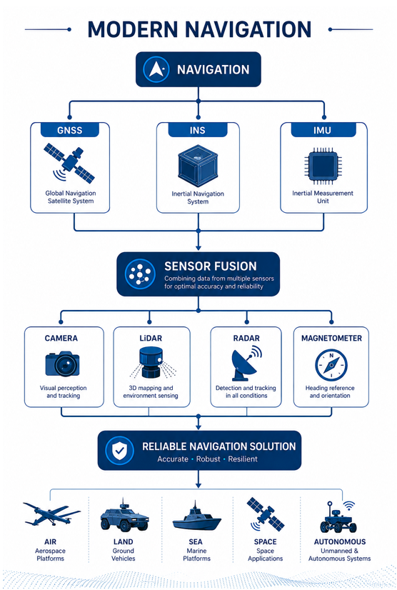
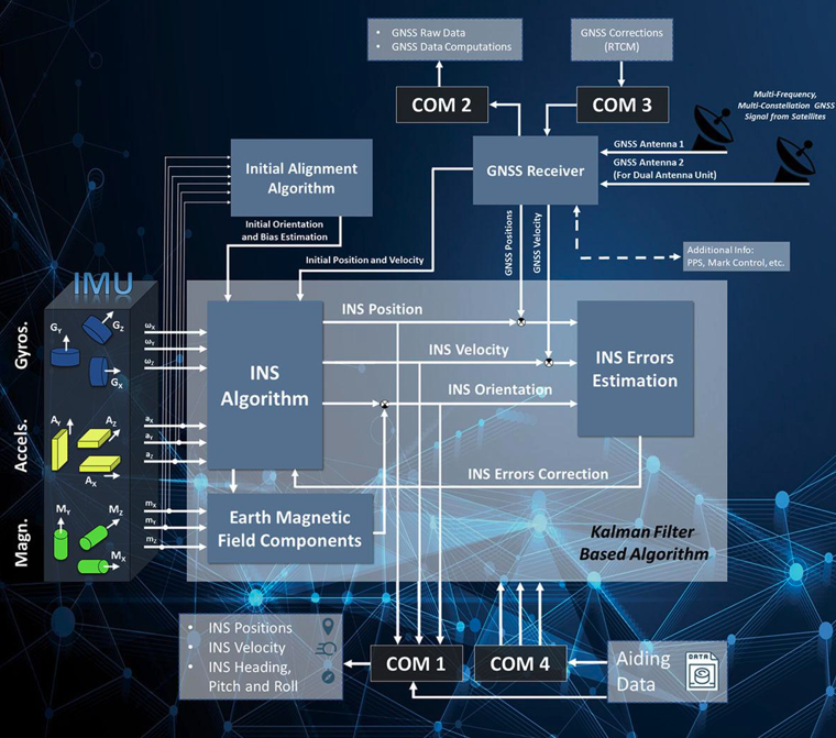
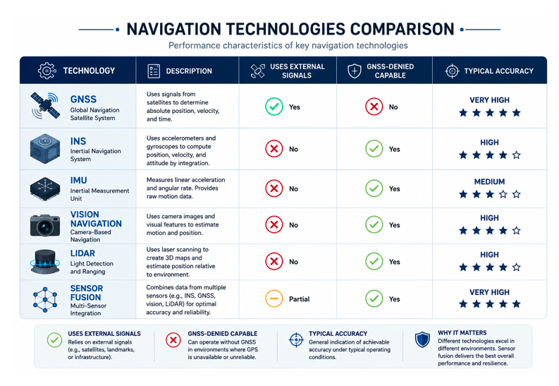
Today’s navigation systems rarely depend on a single source of information. Instead, they combine multiple sensors and positioning technologies to provide continuous and reliable navigation data. Typical navigation systems integrate several complementary technologies that work together through sensor fusion algorithms
Key Navigation Technologies
Global Navigation Satellite Systems (GNSS)
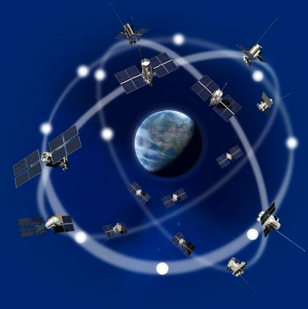
GNSS provides highly accurate global positioning by receiving signals from satellite constellations such as:
- GPS
- Galileo
- GLONASS
- BeiDou
GNSS is widely used because it delivers excellent positioning accuracy under normal operating conditions.
Inertial Navigation Systems (INS)
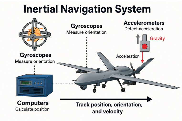
An Inertial Navigation System (INS) calculates position, velocity, and orientation using internal motion sensors without relying on external signals.
INS continues operating even when GNSS signals become unavailable, making it essential for defense, aerospace, and autonomous applications.
Inertial Measurement Units (IMUs)
IMUs contain accelerometers and gyroscopes that measure linear acceleration and rotational movement.
Modern IMUs use technologies including:
- MEMS sensors
- Fiber Optic Gyroscopes (FOG)
These sensors provide the motion data required for accurate inertial navigation.

Sensor Fusion
Sensor fusion combines information from multiple navigation sources into a single reliable navigation solution.
Typical inputs include:
- GNSS
- INS
- IMU
- Cameras
- Radar
- LiDAR
- Wheel odometry
- Magnetometers
By comparing multiple data sources, navigation systems improve accuracy and reliability.

Alternative Navigation Methods
When satellite signals are unavailable, navigation systems may rely on alternative technologies such as:
- Vision-based navigation
- Terrain matching
- Radar navigation
- LiDAR mapping
- Celestial navigation
- Signals of Opportunity (SoOP)
These methods increase navigation resilience in challenging environments.
Navigation in Challenging Environments
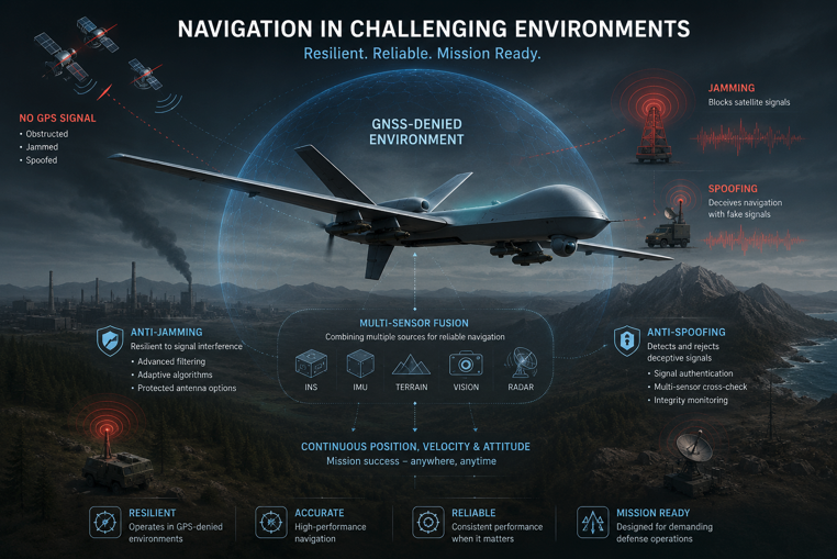
Navigation systems often operate in environments where traditional satellite positioning is unreliable.
Examples include:
- Urban canyons
- Underground facilities
- Indoor environments
- Dense forests
- Mountainous terrain
- Polar regions
- Tunnels
- Electronic warfare environments
- GPS-denied areas
Modern navigation solutions combine multiple technologies to maintain continuous positioning despite these challenges.
Applications of Navigation Systems
Navigation technologies play a critical role across numerous industries.
Defense
Military vehicles, aircraft, naval vessels, missile systems, and unmanned platforms depend on accurate navigation for mission planning, maneuvering, and operational effectiveness in contested environments.
Aerospace
Commercial and military aircraft rely on integrated navigation systems for flight management, precision approaches, and continuous positioning during GNSS disruptions.
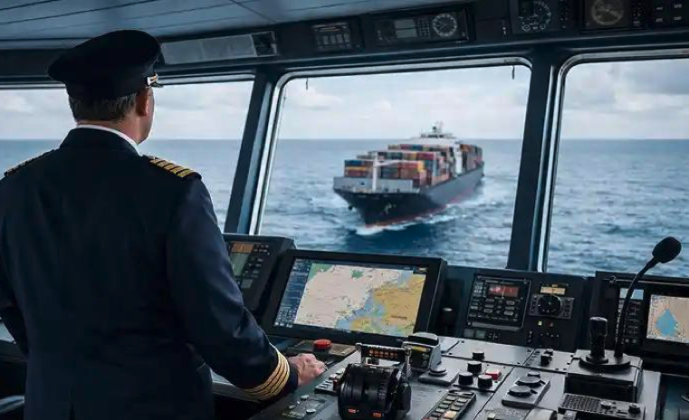
Maritime Ships require reliable navigation for open-ocean travel, coastal operations, harbor approaches, offshore energy projects, and naval missions.
Autonomous Systems
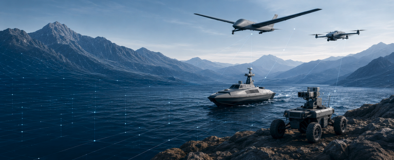
Autonomous drones, robotic vehicles, and unmanned ground systems depend on continuous navigation to operate safely without direct human control.
Surveying and Mapping
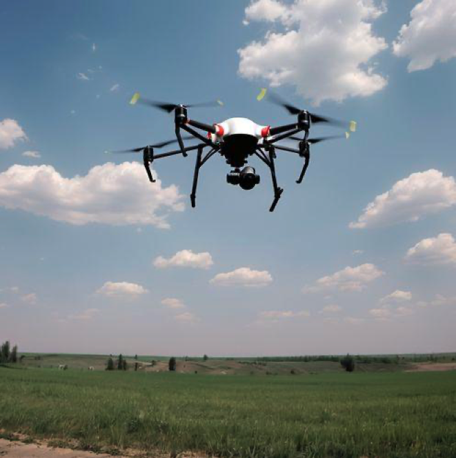
High-precision navigation enables accurate data collection for geospatial mapping, infrastructure inspection, and construction projects.
Critical Infrastructure
Navigation and timing systems support transportation networks, telecommunications, power distribution, emergency response, and other essential services.
Benefits of Modern Navigation Systems
Organizations using advanced navigation technologies benefit from:
- Highly accurate positioning
- Improved operational efficiency
- Enhanced safety
- Continuous navigation availability
- Greater mission reliability
- Better situational awareness
- Increased resilience against signal disruption
- Support for autonomous operations
- Reduced operational risk
The Future of Navigation
Navigation technology continues to evolve rapidly as industries demand greater accuracy, resilience, and autonomy.
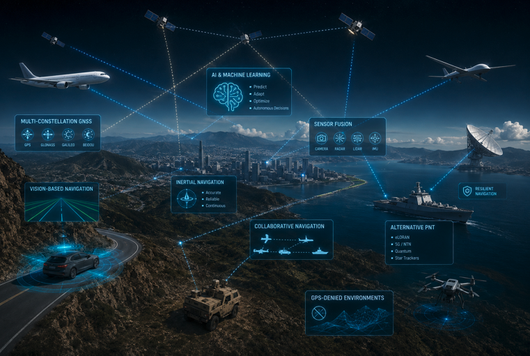
Future navigation systems will increasingly integrate:
- Artificial Intelligence (AI)
- Advanced sensor fusion
- Multi-constellation GNSS
- Inertial navigation
- Vision-based navigation
- Collaborative navigation between platforms
- Alternative PNT technologies
- Resilient navigation architectures for GPS-denied environments
These innovations will enable reliable navigation even in the most demanding operational conditions.
Conclusion
Navigation is the foundation of modern mobility across defense, aerospace, maritime, autonomous systems, and critical infrastructure. While GNSS remains a key component of today’s navigation solutions, modern operations increasingly require systems capable of maintaining accurate positioning when satellite signals are degraded or unavailable.
By combining inertial navigation, satellite positioning, sensor fusion, and alternative navigation technologies, modern navigation systems provide the reliability, accuracy, and resilience needed for today’s complex operational environments.
As autonomy and electronic warfare continue to shape the future, resilient navigation technologies will remain essential for ensuring safe, accurate, and uninterrupted operations across every domain.